Geographically visualizing the scope of the 1922 Industrial Survey is vital to understanding how representative the survey is of Crow daily life.
The archives at Montana State University in Bozeman, Montana, has a plat map of every allotment on the Crow Reservation from 1923. The names and allotment numbers from the plat map correspond with the names and allotment numbers of individual heads of household included in the 1922 survey. The Crow Reservation at the time encompassed nearly 3 million acres, and the plat maps were divided into 107 individual survey townships. We stitched all 107 plats into one large map of the reservation, overlaid the historic maps on modern data from the Bureau of Land Management, and corrected for any skew resulting from the hand-drawn maps. Then we identified every surveyed individual's parcels of land in the plat maps and linked the survey files to the map.
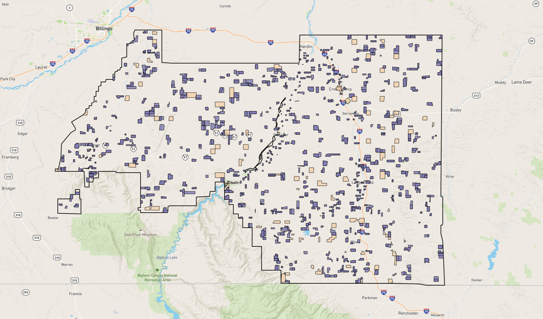
The current prototype of the map is available by clicking the image below or by navigating to its direct URL. All of the properties outlined in purple are individual Crow land holders. All the tan properties either belong to the State of Montana, other utility services, schools, or missions. The map is interactive and clickable. There are a few ways to interact with the map.
- Search Bar: To help descendants search the map for their ancestors, we included a search box on the left of the screen. This tool is available by clicking the magnifying glass. Please note that many of the individuals in the 1922 survey owned multiple properties. When you search for an individual, all their properties will be highlighted in green. You may need to zoom out to see all the properties.
- Individual Parcels: Users can simply click on a parcel of land to read more about the owner. The default information presented includes the name of the individual surveyed, a link to the full survey on the ReFramed archive, and the commentary that Agent Asbury wrote on each survey form. We encourage you to play around with these variables and select from many other options including age, debt, family structure, health, location, etc. Users can change these variables at the top.
Because this is a prototype, we welcome any and all feedback! Do you like it? Is it helpful? Are there ways it could be more useful? Please email rebecca.wingo@uc.edu if you have any questions, suggestions, or concerns. If you would like to see the original plat map, you may download it as a PDF.